
California's 58 counties, mapped by hand
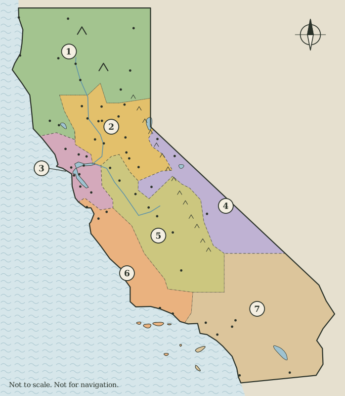
California Sketch Atlas files the state's 58 counties into seven regions and draws each region as a simple map: county seats as numbered dots, national and state parks and a few great landforms as lettered markers.
Each region page explains the land, names every county and its seat, and describes the public landmarks in plain language, with the government documents behind each fact listed at the foot of the page.
The seven regions
- Far North11 counties: Del Norte, Siskiyou, Modoc, Humboldt, Trinity, Shasta, Lassen, Tehama, Plumas, Mendocino, Lake
- Sacramento Valley and Gold Country14 counties: Glenn, Butte, Colusa, Sutter, Yuba, Sierra, Nevada, Placer, Yolo, Sacramento, El Dorado, Amador, Calaveras, Tuolumne
- Bay Area9 counties: Sonoma, Napa, Solano, Marin, Contra Costa, San Francisco, Alameda, San Mateo, Santa Clara
- High Sierra and the East4 counties: Alpine, Mono, Mariposa, Inyo
- San Joaquin Valley8 counties: San Joaquin, Stanislaus, Merced, Madera, Fresno, Kings, Tulare, Kern
- Central Coast6 counties: Santa Cruz, San Benito, Monterey, San Luis Obispo, Santa Barbara, Ventura
- Southern California6 counties: Los Angeles, Orange, San Bernardino, Riverside, San Diego, Imperial
- 58 countiesEach has a county seat, listed by the California Secretary of State and shown on this site's maps as a numbered dot.
- 163,695 sq miThe state's total area in the US Census Bureau's measurements: 155,779 square miles of land and 7,916 of water.
- 39,538,223 peopleCalifornia's population at the 2020 Census, the most of any state.
Seven regions, read from north to south
The grouping is this atlas's own, chosen so that each map holds a sensible number of counties and each page tells one connected story. It is not an official division of the state.
-
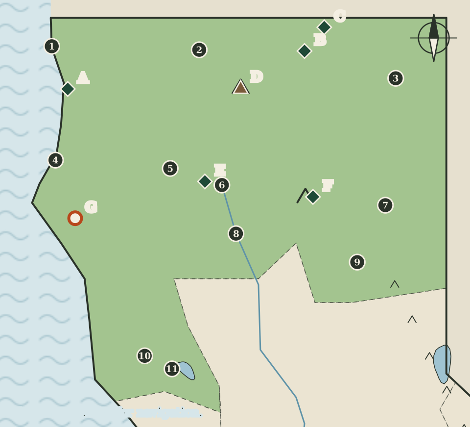
The Far North: redwood coast, volcanoes and high desert
Redwood coast, two great volcanoes and the lava beds of the northeast.
-
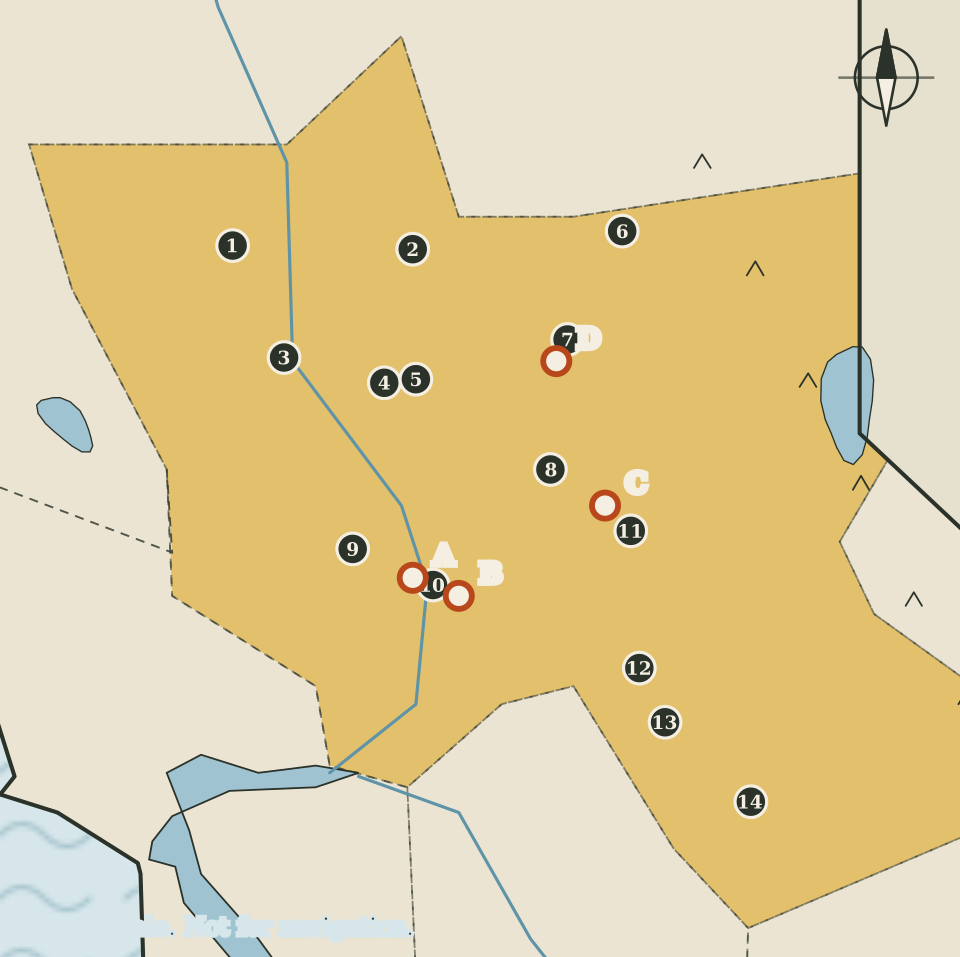
The Sacramento Valley and Gold Country
The capital, the northern Central Valley and the foothill gold belt.
-
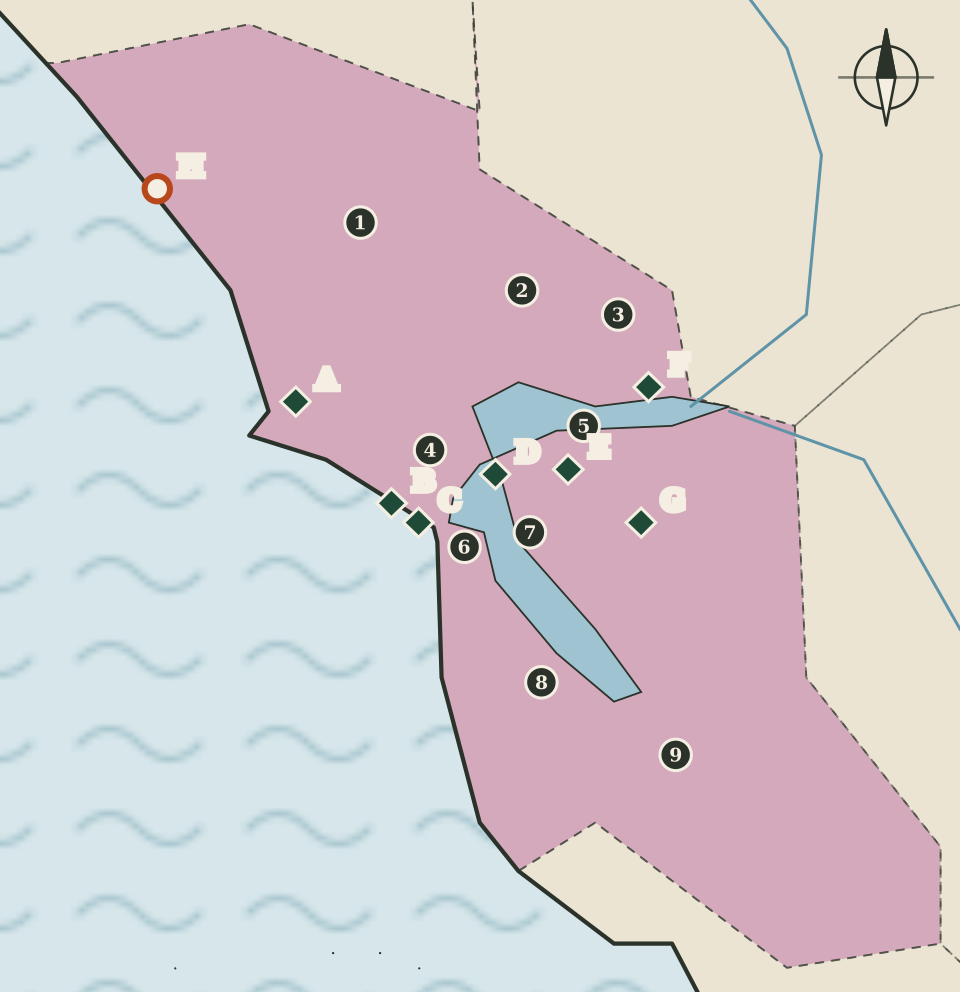
The Bay Area: nine counties around one bay
Nine counties, one bay, and the densest cluster of national park sites in the state.
-
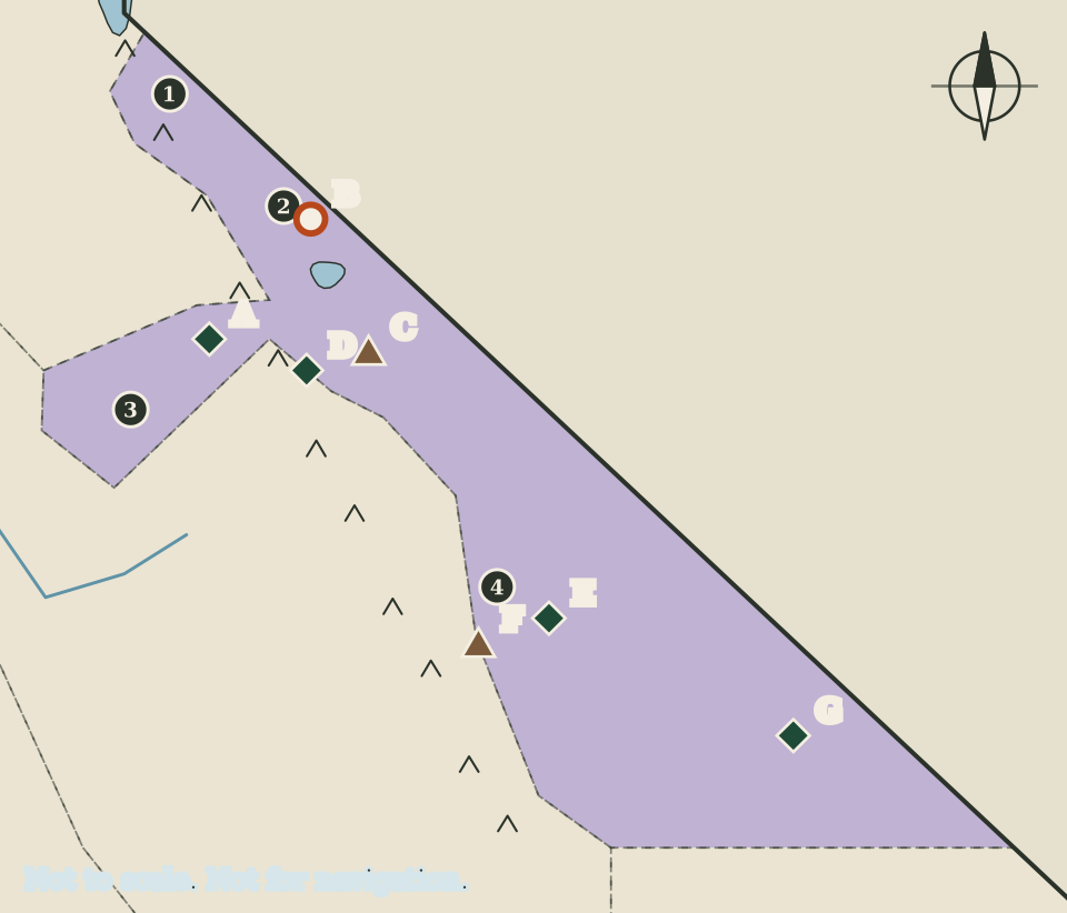
The High Sierra and the East: from Yosemite to Death Valley
Yosemite, Bodie, Manzanar, and the highest and lowest points in the state.
-
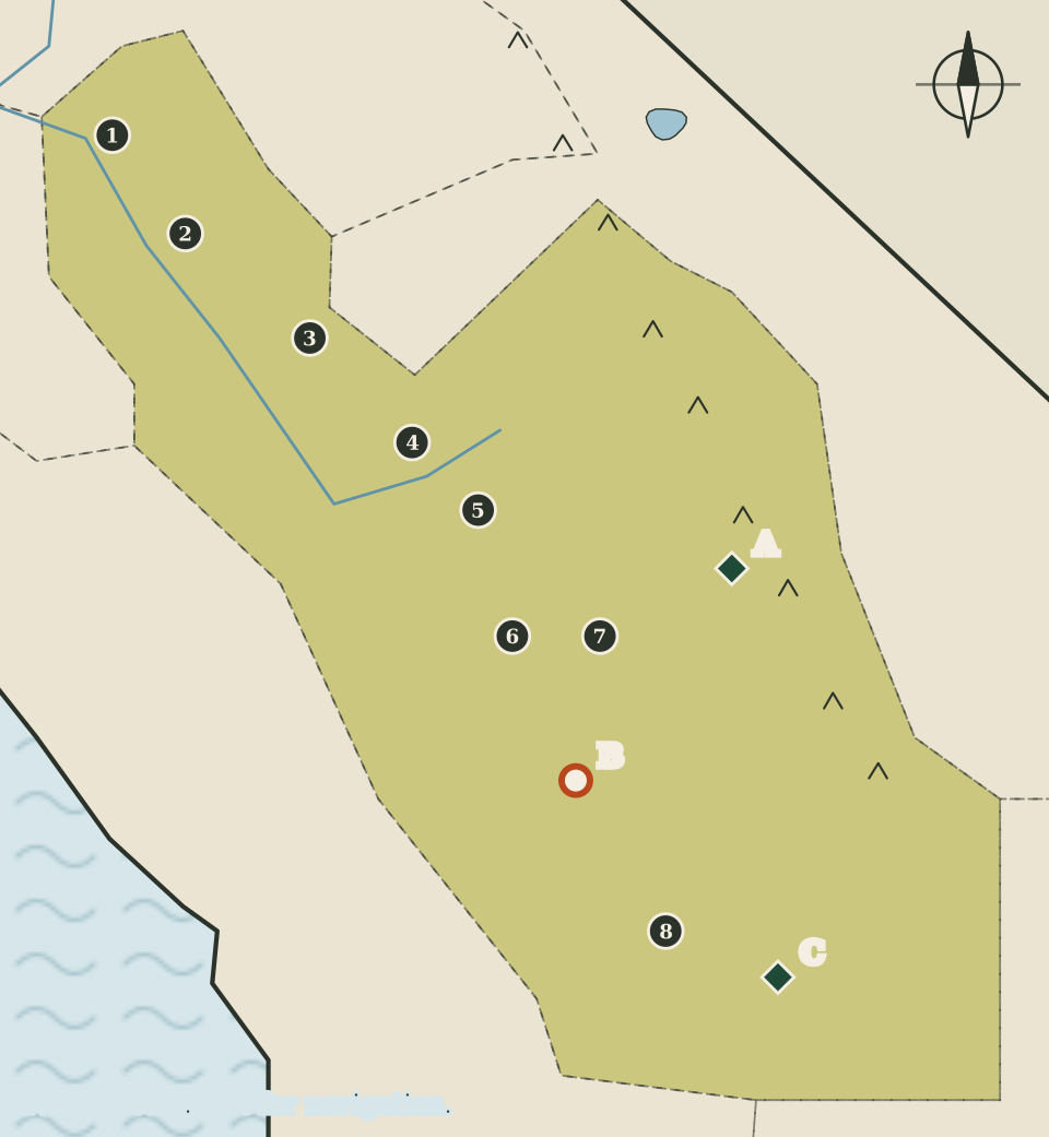
The San Joaquin Valley: the southern Central Valley and its mountain edge
Farm valley, giant sequoias, Allensworth and the Chávez monument.
-
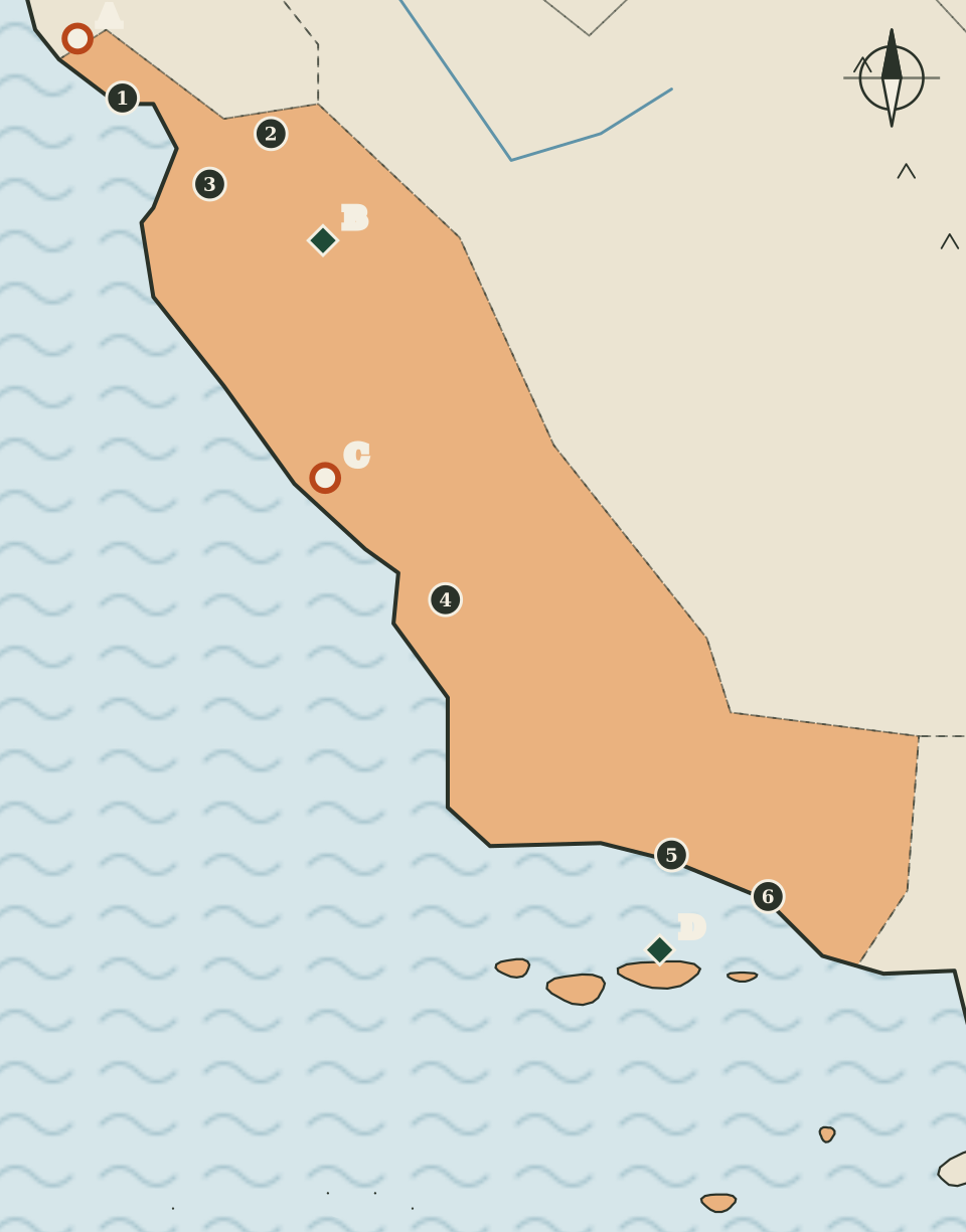
The Central Coast: redwoods, spires and offshore islands
The oldest state park, Pinnacles, Hearst San Simeon and the Channel Islands.
-
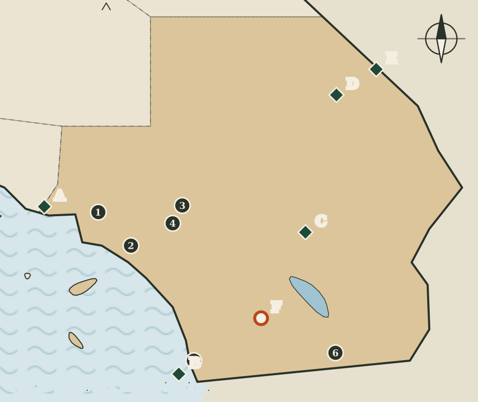
Southern California: six counties from the coast to the Colorado River
Coast, mountains and two deserts, from Cabrillo's landing to the Mojave.
Drawings for reading, not maps for driving
Every map here is drawn as code from a few hundred rough points, then given a slightly wobbly pen line. Coastlines are simplified, region borders only follow county lines approximately, and dots are placed by eye. That makes the maps quick to read and honest about what they are: illustrations that show where things are in relation to each other.
The tallest mountain in the lower 48 states and the lowest point in North America make the point. The National Park Service gives Mount Whitney's summit as 14,505 feet and Badwater Basin in Death Valley as 282 feet below sea level. On the High Sierra map they sit a short way apart, and the drawing gives no sense of the real distance between them.
- Seats from the state's own listCounty seats are taken from the California Secretary of State's table of political subdivisions by county.
- Landmarks with a public sourceA park or landform appears only when a National Park Service, US Geological Survey or California State Parks page describes it.
- Nothing for saleNo tours, bookings, affiliate links or advertising. The atlas is independent of every agency it cites.